Did you know that a staggering 76% of consumers expect personalization from businesses (McKinsey)? This point underscores the critical need for solid consumer demographic insights.
Retailers and commercial real estate (CRE) professionals alike face the challenge: How best to access and utilize this data? Geographic information systems (GIS) offer a powerful solution.
In this guide, we'll reveal seven ways GIS can sharpen your understanding of consumer demographics and drive informed decision-making. Read on to transform data into strategy.
What are Consumer Demographics?
Consumer demographics are a set of categories or characteristics of consumers that are used for marketing purposes.
Consumer demographics give important information about factors such as:
- Age
- Gender
- Race/ethnicity
- Household income
- Geographic location
- Education level
This data helps businesses understand their target audience and preferences. In CRE, consumer demographics help with various activities such as:
- Market analysis
- Targeted marketing
- Property development and investment decisions
- Risk assessment
- Tenant attraction and retention
If you know the demographics of your target audience, you can focus your marketing efforts on your best type of customer.
It’s a more efficient and cost-effective way to market your offerings and attract new clients.
So how do you go about this?
Understanding Consumer Demographics through GIS
GIS is a tool used to analyze and interpret geographical information, and in CRE, this information includes:
- Property boundaries
- Land use assessments
- Market trends
GIS lays the foundation for property location insights and market research. Businesses can gain a deeper understanding of their target audiences by layering different data sets.
GIS gives CRE professionals the analytics and intelligence needed for improved site selection, portfolio management, and more.
GIS has evolved from basic mapping techniques to sophisticated spatial analytics. Today, it integrates demographic, socioeconomic, and psychographic data for deeper insights. The result is better and more efficient decision-making in business strategies.
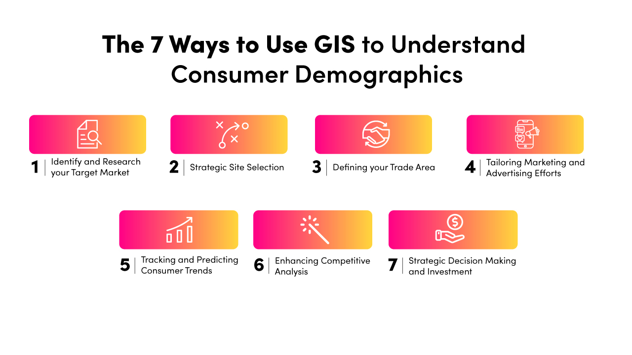
7 Ways to Use GIS to Understand Consumer Demographics
GIS uses a combination of different types of spatial data to assess factors that affect CRE decisions.
The types of data include:
- Maps
- Satellite imagery
- Demographic information
- Land use patterns
- Transportation networks
Having this data on hand enables CRE professionals to do a spatial analysis. You can overlay and analyze the relationship between different data sets to optimize business processes. A competitive advantage in your market is then literally at your fingertips.
Let’s look at a few ways to use GIS to your advantage in terms of consumer demographics.
1. Identify and Research your Target Market
Developers and investors combine geographic, demographic, and psychographic data using GIS to help them identify target markets.
The data includes factors within specific geographical boundaries such as:
- Population density
- Income distribution
- Consumer behavior patterns

Geographic accuracy is especially important in CRE. It is necessary to understand the nuances of different neighborhoods, and the preferences and needs of prospective tenants and customers who live in them.
Insights gained can help retailers to better tailor products and marketing efforts for their specific target audience.
2. Strategic Site Selection
Location is king in commercial real estate. GIS makes it easier for businesses, especially retail chains and franchises, to expand to new locations, because it sheds light on important aspects such as:
- Proximity
- Accessibility
- Visibility
- High-demand areas
- An ideal client base
- Car and toot traffic patterns
- Competitors
- Local amenities
GIS also aids in risk assessment and mitigation by identifying environmental risks, zoning regulations, and legal restrictions.
GIS can help to create predictive models based on historical data trends.
These models help to forecast future property values and identify areas likely to experience growth or decline.
3. Defining your Trade Area
GIS helps businesses define their trade or catchment areas by analyzing consumer distribution, behavior, and buying patterns. It uses drive-time or distance-based techniques such as concentric circles, drive-time analysis, and spatial clustering.
Once you’ve defined your trade area, GIS can help you visualize and analyze a variety of data-rich insights:
- Customer density
- Purchasing frequency
- Popular locations
- Travel preferences
- Which factors influence their purchasing decisions
4. Tailoring Marketing and Advertising Efforts
With location-specific demographic data, visualizations and insights gained through GIS, you can tailor other aspects of your venture to meet the preferences and needs of the soon-to-be loyal locals:
- Marketing strategies
- Services
- Inventory
- Pricing
Demographic information can be overlaid on maps to identify areas where a high percentage of your target audience lives.
This allows you to create marketing campaigns that target specific geographic areas or communities.
Thinking out of the box, you can also use foot traffic data to create personalized advertisements, like Burger King did in 2019. Apparently, in Mexico people can be stuck in traffic jams for up to five hours at a time.
Burger King took advantage of this by creating the ‘Traffic Jam Whopper’ campaign. They paired location data with beacon technology to send personalized push notifications to customers who were stuck in traffic. Delivery orders increased by 63%!
By customizing marketing efforts based on geographic insights, you can better allocate resources and maximize marketing ROI.
5. Tracking and Predicting Consumer Trends
GIS helps to analyze consumer behavior by mapping foot traffic, sales, and demographic changes over time. This helps businesses anticipate future trends, such as changing shopping preferences or seasonal foot traffic patterns.

Understanding these trends is essential for anticipating future consumer behavior trends and making informed decisions.
One of the ways to use GIS to detect high foot traffic areas is by collecting passive data from different sensors and devices that record people’s movement. GIS can use mobile phone signals or GPS trackers, among other things, to track walking trajectories, routes, and locations.
Tracking foot traffic trends over the course of a holiday can help retailers predict increased demand. They can then stay ahead of market dynamics and adjust their inventory, staffing, and marketing strategies accordingly.
6. Enhancing Competitive Analysis
GIS is a powerful tool for measuring competitors’ market presence and understanding their customer base. GIS helps analyze competitors' market reach by mapping their locations, customer base overlaps, and market penetration in specific areas.
By plotting these aspects and doing a competitive analysis, businesses can gain valuable insight into where competitors are stronger or weaker.
GIS-driven competition analysis also helps businesses identify growth opportunities while reducing competition risks. It allows them to make better market entry decisions and allocate resources more efficiently.
Retailers use GIS to find market opportunities where competitors have only a small presence. This helps them strategically position themselves to open new stores in underserved markets, giving them a competitive advantage.
7. Strategic Decision Making and Investment
GIS offers a wealth of spatial insights and data that enables businesses to make real-world decisions based on facts, rather than guesses or assumptions.
By looking at consumer demographics, market trends, and infrastructure features through GIS, you can identify many important aspects such as:
- High growth areas
- Good market conditions
- Proximity to critical infrastructure
- Potential environmental risks
For example, a real estate investment company can use GIS data to assess population growth, income levels, and development plans in a specific area. This data is then used to determine the best location for a new multifamily development project, for example.
GIS spatial data guides strategic decisions by providing in-depth understanding of geographic factors influencing consumer behavior.
It helps businesses reduce risks by accurately gauging factors such as:
- Market demand
- Competitive pressures
- Future growth opportunities
GIS lets businesses make decisions based on data-driven insights that match market opportunities and trends.
It is useful in the decision-making process for property investments and developments, too. GIS can track and analyze the performance of new locations, allowing businesses to adjust and plan future expansions. Visual representations of complex data help with clear communication about expansion plans.
Final Thoughts on Using GIS for In-Depth Consumer Insights
We've journeyed through the ways GIS can be a game-changer in comprehending consumers’ characteristics and needs. These seven highlighted strategies demonstrate how spatial intelligence equips CRE businesses with data-backed knowledge and foresight.
Now, with a more nuanced understanding of GIS's capabilities, we ask you the question: Are you fully tapping into GIS to decode the language of your consumer base? If you’d like to get started with GIS consumer insights, book a demo with AlphaMap, today.